
Sheep Creek Trails
Sheep Creek Forest Service Road (FSR) provides access to three hikes, each going to a subalpine lake in a different drainage. The hikes are of varying difficulty. From north to south they are Panther Lake, Curtis Lake and Waldie (Wulf) Lake. The BC Backroad Mapbook provides accurate road descriptions to each of the lakes. For Panther and Curtis stay left at the Sheep-Waldie FSR fork. For Waldie, go right at Sheep-Waldie FSR fork. The distances for all of the hikes are approximate. All of the lakes have fish.
Panther Lake
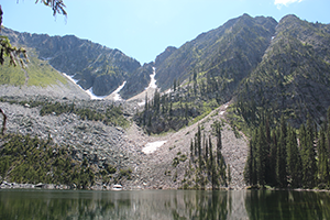 *Due to drainage ditches, you will need a high clearance 4wd vehicle to access Panther Lake TH*.Distance: 3.9 km Hiking time: 2 hour one way Elevation gain: 335 m (1100 feet) Description: The trail into Panther Lake has been worn deep by the miners and pack animals who used this route in the early 1900’s to access the Bayonne and Sunshine Mines. Now, anglers keep the tread open as they climb the steep trail to Panther Lake, where they share the fishing with osprey. At the far end of Panther Lake, a terminal moraine creates a peninsula that is perfect to cast from. There is a trail around the lake. Hikers and history buffs can still find traces of the original trail that the old miners used as they led their pack animals over the pass at the end of Panther Lake. Listen for whistling marmots as you work your way up these passes. Ridge walkers will enjoy the Three Sisters Peaks. Set at the foot of the Three Sisters Peaks, Panther Lake, with rock slides to it’s shores and sub-alpine forests surrounding it, is truly beautiful. There are no facilities at the lake, but campers have cleared 2 small tent sites, one at each end of the lake.
Curtis Lake
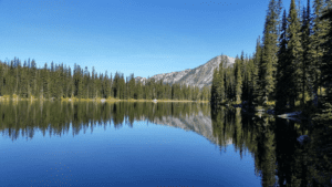 From the trailhead the ATV trail climbs steadily up the valley on an old road, through a logged area. Shortly after crossing a stream on stepping stones, watch for a path marked with fluorescent orange squares. The path climbs steeply, working its way through dense undergrowth. It passes through a wet sub-alpine meadow just before the lake. Curtis Lake, at 1829 m (6000 feet) is a beautifully shaped and coloured body of water, surrounded by peaks up to 2,222 m (7,289 feet) tall. The combination of rock, water, balsam fir and lush sub-alpine meadow vegetation make this spot one of the loveliest in the area. Open scree and talus slopes invite ridge walking. Curtis Lake is a popular with fishermen. There is one small campsite at the lake.
Waldie Lake
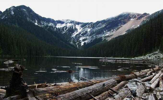 The access to Waldie Lake, (also known locally as Wulf Lake) requires a good high clearance 4wd vehicle. If you do not have this you can walk up the road to the trail but it is a long haul. The actual trail into Waldie Lake is 4km long with a moderate grade. A second lake is beyond the main Waldie for those wanting an additional
hike.